How my drone spots crop problems before they spread.
The relentless pursuit of healthier crops and higher yields has always been the farmer’s core mission. For generations, this meant countless hours walking fields, eyes scanning for any sign of trouble – a yellowing leaf, a wilting stalk, or the tell-tale bite marks of a pest. While this hands-on approach is invaluable for understanding the land, it’s inherently limited, especially on larger farms. The sheer scale makes it impossible to catch every emerging issue before it escalates, often leading to widespread damage, significant yield losses, and increased input costs. However, a quiet revolution is underway in agriculture, a technological leap that’s transforming how we identify and manage crop health. This revolution flies high above our fields, providing an unprecedented view and allowing us to spot crop problems with remarkable precision and speed, often before the human eye can even discern them.
The Problem I Couldn’t Ignore
For years, my approach to crop health management was largely reactive. I’d walk sections of my fields, relying on visual cues to identify potential issues. This traditional method, while deeply ingrained in farming practices, presented a myriad of challenges that often led to significant setbacks. The most pressing issue was the sheer scale of the operation. Covering hundreds, sometimes thousands, of acres on foot or even with a vehicle is not only incredibly time-consuming but also physically exhausting. By the time a problem became visible enough to be spotted from the ground, it often meant it had already taken root and begun to spread, sometimes across a substantial portion of the field.
This delayed detection had severe consequences. A patch of nutrient deficiency, initially small, could expand rapidly, stunting growth and reducing yield potential in a widening area. A localized pest infestation, if not caught early, could decimate a crop before effective countermeasures could be deployed. And perhaps most critically, the onset of a plant disease, often subtle in its initial stages, could quickly become an epidemic, leading to widespread crop failure and devastating financial losses. The common adage “”an ounce of prevention is worth a pound of cure”” felt particularly poignant, yet prevention was incredibly difficult when detection was so late.
Furthermore, the lack of precise information often led to blanket applications of pesticides or fertilizers. This “”spray and pray”” approach was not only costly and inefficient, but it also carried significant environmental implications, impacting soil health, beneficial insects, and water quality. I knew there had to be a better way – a method that could offer earlier, more precise insights, allowing for targeted interventions that saved time, money, and minimized environmental impact. The traditional methods were simply no longer sustainable or effective enough to meet the demands of modern agriculture and the increasing pressures on profitability and environmental stewardship. The need for a more proactive, data-driven approach to drone spots crop problems became undeniably clear.
Why I Ditched Walking Fields
The decision to move beyond traditional field scouting wasn’t made lightly. For generations, farmers have relied on their boots on the ground, an intimate knowledge of their land, and a keen eye for detail. I respected that tradition, but I also recognized its inherent limitations in the face of modern agricultural challenges. The primary driver for change was efficiency. Manually scouting large fields is an incredibly labor-intensive process. Even with a dedicated team, covering every acre thoroughly and consistently is virtually impossible. We’d often spend days, sometimes weeks, methodically surveying fields, only to find that by the time we reached the far end, a problem we’d missed at the beginning had already worsened.
Another significant drawback was the perspective. When you’re walking through a field, you’re viewing the plants from eye level. While this allows for close inspection of individual plants, it makes it incredibly difficult to identify patterns or anomalies across a wider area. A small patch of discoloration might be visible, but understanding its extent, its relationship to other affected areas, or its potential origin is much harder from the ground. It’s like trying to understand a large painting by focusing on one brushstroke at a time – you miss the bigger picture. This limited perspective often meant that crop problems were identified only once they were significant enough to be seen from ground level, by which point intervention was often more costly and less effective.
Moreover, the data collected from manual scouting was often subjective and inconsistent. One scout might interpret symptoms differently than another, or miss subtle cues entirely due to fatigue or varied experience levels. This made it challenging to track the progression of issues over time or to compare data across different sections of the farm accurately. I needed a system that could provide objective, consistent, and comprehensive data, allowing for precise, repeatable measurements and insights. The limitations of manual scouting, from its inefficiency and limited perspective to its subjective data collection, made it clear that a technological leap was necessary. This realization led me to explore precision agriculture drone technology, a solution that promised to revolutionize how I approached crop scouting and ultimately, how I managed my farm’s health.
How My Drone Sees Trouble
The real magic behind drone crop monitoring lies in its ability to see beyond what the human eye can perceive. It’s not just about getting an aerial view; it’s about the advanced sensor technology that transforms that view into actionable data. My primary tool for this is a professional-grade agricultural drone equipped with a suite of specialized sensors. While a standard RGB (Red, Green, Blue) camera, much like the one on your smartphone, can provide excellent visual imagery for spotting obvious issues like significant wilting or large pest damage, its capabilities are limited for early detection.
The true game-changer is the multispectral sensor. This sensor captures light across specific bands of the electromagnetic spectrum, including visible light (red, green, blue) as well as near-infrared (NIR). Why is this important? Because healthy plants reflect a lot of near-infrared light and absorb a lot of red light. Stressed or diseased plants, on the other hand, reflect less NIR and more red light. By analyzing the ratios of these different light wavelengths, the drone’s software can calculate various vegetation indices, such as the Normalized Difference Vegetation Index (NDVI). A high NDVI value typically indicates healthy, vigorous plant growth, while lower values can signal stress, nutrient deficiencies, or the early stages of disease. This allows the drone to spot crop problems long before any visible symptoms appear to the naked eye.
Beyond multispectral, I also utilize a thermal sensor for specific applications. Thermal imaging detects heat signatures, which can reveal issues like water stress (stressed plants tend to be warmer due to reduced transpiration) or even the presence of certain pests that emit heat. The process involves flying the drone over the fields following a pre-planned route, ensuring consistent altitude and overlap for accurate data stitching. Once the imagery is collected, it’s processed using specialized software that creates detailed orthomosaic maps and generates the various vegetation index maps. These maps highlight areas of concern, often represented by different colors, allowing for precise identification and geo-location of problematic zones. This advanced vision capability is what truly enables my agricultural drone to provide unparalleled insights into crop health, transforming reactive management into proactive intervention.
Spotting Disease: Real Examples
The power of drone detection of crop disease and other issues becomes truly evident when you look at real-world applications on my farm. One of the most common and costly problems we face is nutrient deficiency, particularly nitrogen. In corn, for instance, early nitrogen deficiency can manifest as a slight yellowing, but often, by the time it’s noticeable from the ground, significant yield potential has already been lost. My multispectral drone, however, can detect subtle changes in chlorophyll content, reflected in the NDVI values, weeks before visible symptoms appear. I’ve seen areas where the NDVI map shows a dip in vigor, indicating a potential nitrogen shortage. This early warning allows me to conduct targeted soil or tissue samples in those specific zones and apply a variable rate of nitrogen only where it’s needed, preventing widespread stunting and optimizing fertilizer use.
Another critical area is water stress. During dry spells, or in fields with inconsistent irrigation, identifying areas of drought stress quickly is paramount. While visual cues like wilting are obvious, they represent severe stress. My thermal camera on the drone is invaluable here. It can detect slight temperature variations across the field. Plants under water stress close their stomata to conserve moisture, which reduces evaporative cooling and causes their leaf temperature to rise. The thermal map instantly highlights these warmer areas, indicating where irrigation is most urgently needed. This has allowed me to optimize water usage, ensuring precious resources are directed precisely where they’re required, preventing irreversible damage and maximizing water efficiency.
Perhaps the most impactful application is in plant disease detection. Take, for example, the early stages of fungal diseases like rust or blight. These often begin as microscopic spores, slowly developing into small lesions that are nearly impossible to spot from the ground. However, these early infections disrupt the plant’s cellular structure, altering its light reflectance properties. The multispectral sensor picks up these subtle changes in the NIR and red bands, signaling a potential issue. I’ve had instances where the drone flagged a small, irregular patch of reduced vigor. Upon ground truthing, we found the very first signs of a fungal infection, perhaps no larger than a dinner plate. Because we caught it so early, we were able to apply a targeted fungicide application to that precise area, effectively preventing crop spread with drones and saving the rest of the field from potential devastation. These examples underscore how how drones detect crop diseases isn’t just theoretical; it’s a practical, yield-saving reality on the farm.
From Alert to Action Plan
Detecting a problem with a drone is only the first step; the true value lies in how that information is translated into an effective action plan. Once my drone has completed its flight and the data is collected, the real work of analysis begins. The raw imagery, whether RGB, multispectral, or thermal, is processed using specialized photogrammetry software. This software stitches together thousands of individual images into a single, high-resolution orthomosaic map of the entire field. More importantly, for multispectral data, it generates the crucial vegetation index maps, such as NDVI, NDRE (Normalized Difference Red Edge), or CIR (Color Infrared).
These maps are the farmer’s new diagnostic tool. Areas of concern, whether it’s low vigor, water stress, or suspected disease, are clearly highlighted, often in contrasting colors. For example, a healthy green on an NDVI map might turn to yellow or red in areas of stress. The software allows me to pinpoint the exact GPS coordinates of these problematic zones. This geo-referencing capability is critical because it means I can go directly to the precise location in the field for ground truthing. Early crop problem identification drone data isn’t a substitute for boots on the ground; it’s a highly efficient guide. I’ll visit the marked areas to visually inspect the plants, confirm the drone’s findings, and gather additional information like soil samples, leaf tissue samples, or pest counts.
Once the problem is confirmed and identified (e.g., specific nutrient deficiency, pest species, or disease pathogen), the data then directly informs our intervention strategy. Instead of a blanket application across the entire field, we can implement precision agriculture drone-guided variable rate applications. This means applying fertilizer only to the nutrient-deficient zones, targeting pesticides only where pests are active, or fungicides only to areas showing early disease symptoms. This targeted approach has multiple benefits:
- Reduced Input Costs: We use less fertilizer, fewer pesticides, and less water, leading to significant savings.
- Minimized Environmental Impact: Less chemical runoff and reduced exposure for beneficial insects and wildlife.
- Improved Crop Health & Yield: Addressing problems early and precisely ensures the crop receives exactly what it needs, when it needs it, leading to healthier plants and higher yields.
- Optimized Labor: Time previously spent aimlessly scouting is now focused on targeted action.
- Flight Time: Longer flight times mean fewer battery changes and more ground covered per flight. I look for drones offering at least 25-30 minutes of flight.
- Payload Capacity: The drone must be able to comfortably carry the necessary sensors.
- RTK/PPK GPS: This is critical for highly accurate geo-tagging of images, ensuring that the processed maps are precise down to a few centimeters. This accuracy is paramount when you’re trying to pinpoint a small patch of disease or for variable rate application.
- Multispectral Camera: This is my primary sensor for detecting plant stress and vigor. It captures data across multiple spectral bands (typically blue, green, red, red edge, and near-infrared). Brands like MicaSense or Parrot Sequoia are popular and reliable choices.
- RGB Camera: While not for advanced analysis, a high-resolution RGB camera is still valuable for general visual scouting, identifying large-scale issues, or for creating detailed visual maps of the farm.
- Thermal Camera (Optional but Recommended): For specialized tasks like identifying water stress, irrigation leaks, or even some pest activity, a thermal camera is invaluable.
- Flight Planning Software: Programs like Pix4Dcapture, DJI GS Pro, or DroneDeploy allow you to pre-plan autonomous flight paths, specifying altitude, overlap, and capture parameters. This ensures consistent data collection.
- Data Processing Software: After the flight, the images need to be stitched together and analyzed. Pix4Dmapper, Agisoft Metashape, or cloud-based solutions like DroneDeploy or Taranis are commonly used. These platforms generate the orthomosaic maps, NDVI maps, and other vegetation indices.
- GIS/Farm Management Software: Integrating the drone-generated maps into a broader farm management system (e.g., John Deere Operations Center, Climate FieldView) allows for seamless data overlay with other farm data (soil types, yield maps) and facilitates variable rate prescription map creation.
- Large-Scale Farms: For operations covering hundreds or thousands of acres, manual scouting is simply impractical. Drones offer the efficiency to cover vast areas quickly and comprehensively.
- High-Value Crops: If you’re growing crops with high economic value, the potential yield loss from undetected issues can be substantial. Early detection and precise intervention become even more critical for profitability.
- Farmers Practicing Precision Agriculture: If you’re already utilizing GPS-guided machinery, variable rate applications, or other data-driven farming techniques, drones are a natural and powerful extension of your existing system.
- Those Seeking Sustainability: Drones enable more targeted applications of inputs, reducing overall chemical use and promoting more environmentally friendly farming practices.
- Operations with Resource Constraints: If labor is scarce or expensive, drones can significantly augment your scouting capabilities without adding more personnel.
- Initial Investment: A professional-grade agricultural drone with multispectral sensors and robust software can represent a significant upfront cost. However, consider the long-term ROI from saved inputs and increased yields.
- Learning Curve: There’s a learning curve involved in operating the drone, planning flights, and especially in processing and interpreting the data. While user-friendly software exists, a basic understanding of remote sensing principles is beneficial.
- Data Management: Drones generate a lot of data. You need a system for storing, processing, and analyzing this information effectively. Cloud-based solutions can help, but a reliable internet connection and sufficient computing power are often required.
- Regulations: Drone operation is subject to local aviation regulations. Understanding and complying with these rules, including licensing and airspace restrictions, is crucial.
- Ground Truthing: Drone data provides insights, but it doesn’t replace the need for ground truthing. You still need to physically inspect areas flagged by the drone to confirm the issue and determine the best course of action.
This streamlined workflow, from drone spots crop problems to data analysis and precise intervention, transforms reactive farming into a proactive, data-driven system, ensuring that every action taken is deliberate, efficient, and maximally effective.
My Farm Drone Setup
For anyone considering adopting farm drone technology, understanding the practical setup is crucial. My current UAV crop inspection system is built around a few key components, chosen for their reliability, sensor capabilities, and ease of use in an agricultural context.
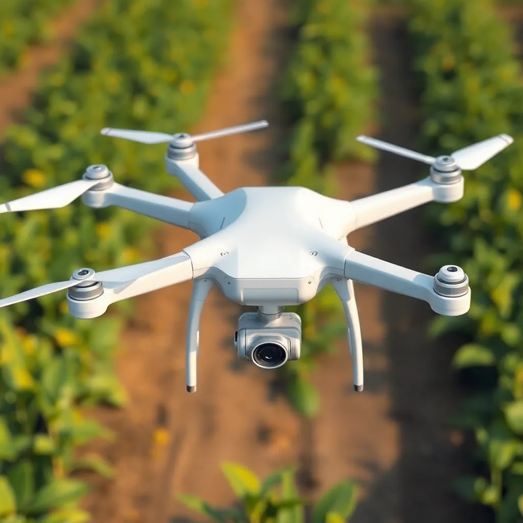
First, the drone platform itself. I opted for a multirotor drone, specifically a quadcopter, due to its vertical take-off and landing (VTOL) capabilities, which are ideal for smaller fields or areas with limited space for runway take-off. It also offers excellent maneuverability and the ability to hover for detailed inspection. While fixed-wing drones are excellent for covering vast areas very quickly, their requirement for a runway and less agile flight characteristics made them less suitable for my varied field sizes and needs. Key considerations for the drone include:
Second, the sensors. This is arguably the most important part of the setup for crop health monitoring drone capabilities.
Third, the software. This is where the raw data transforms into actionable insights.
Finally, batteries, chargers, and a robust field case are essential for practical operation. I always carry multiple charged batteries to maximize flight time and minimize downtime. Understanding local drone regulations and obtaining necessary certifications or licenses is also a non-negotiable step before any flights commence. The initial investment in a quality agricultural drone setup can be substantial, but the return on investment through optimized input use, reduced losses, and increased yields often justifies the cost within a few seasons.
Is Drone Scouting For You?
The integration of drone spots crop problems technology into my farming operation has been nothing short of transformative. It has shifted my approach from reactive problem-solving to proactive, data-driven management. However, the decision to invest in benefits of drone crop scouting is a significant one, and it’s important to assess whether it’s the right fit for your specific needs and operation.
Who benefits most from drone scouting?
What are the considerations and challenges?
Ultimately, can drones identify crop issues effectively? Absolutely. They provide an unprecedented level of detail and a birds-eye view that manual methods simply cannot match. They empower farmers to make more informed decisions, optimize resource allocation, and enhance overall crop health and yield. If you’re looking to elevate your farm’s efficiency, profitability, and sustainability, exploring how do drones detect crop diseases and integrate into your operation is a step worth taking. It’s an investment not just in technology, but in the future resilience and success of your farm.
The journey from traditional field scouting to advanced drone-based crop monitoring has been a revelation for my farm. The ability to have a comprehensive, data-rich overview of every acre, and to spot crop problems with such precision and speed, has fundamentally changed how I approach crop health. No longer are we reacting to widespread issues; instead, we are proactively identifying subtle anomalies, pinpointing their exact location, and intervening before they can escalate. This shift has not only led to significant savings in inputs like fertilizers and pesticides but has also resulted in healthier crops, higher yields, and a more sustainable farming operation. The benefits of drone crop scouting extend far beyond mere convenience; they represent a powerful leap towards truly intelligent and efficient agriculture. As we continue to face evolving challenges in farming, from climate variability to increasing demands for sustainable practices, technologies like the agricultural drone will undoubtedly play an even more critical role in ensuring the health and productivity of our fields for generations to come.